Just over a year ago, we announced the Terrain Tiles service in cooperation with the Amazon Web Services (AWS) team. The Terrain Tiles Public Dataset offers digital elevation models (DEMs) for the entire Earth, with varying resolutions of data sourced from open data providers from around the world. More than 50 million terrain requests are made every day, making it one of the most popular Public Datasets offered by AWS.
The Mapzen Tiles team, with the help of Seth Fitzsimmons, have spent the last couple months making improvements to the Terrain Tiles in two important ways: We’ve added several newer, higher resolution sources in more countries, especially in Europe, and improved the software to use more modern Amazon Web Services products so that it can make more efficient use of cloud resources as we update the data.
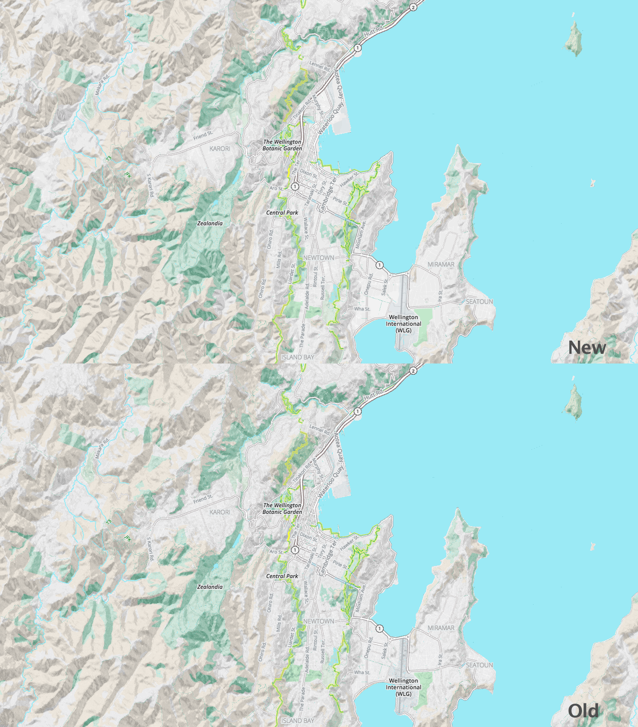
 Updated terrain data around Wellington, New Zealand
We added high resolution data that covers the Arctic (including Alaska, Canada, Greenland, Norway, Iceland, and Russia), Australia, Austria, Canada, Europe (covering Albania, Austria, Belgium, Bosnia and Herzegovina, Bulgaria, Croatia, Cyprus, Czech Republic, Denmark, Estonia, Finland, Former Yugoslav Republic of Macedonia, France, Germany, Greece, Hungary, Iceland, Ireland, Italy, Kosovo, Latvia, Liechtenstein, Lithuania, Luxembourg, Malta, Montenegro, Netherlands, Norway, Poland, Portugal, Romania, Serbia, Slovakia, Slovenia, Spain, Sweden, Switzerland, and United Kingdom), Mexico, New Zealand, Norway, and the United Kingdom.
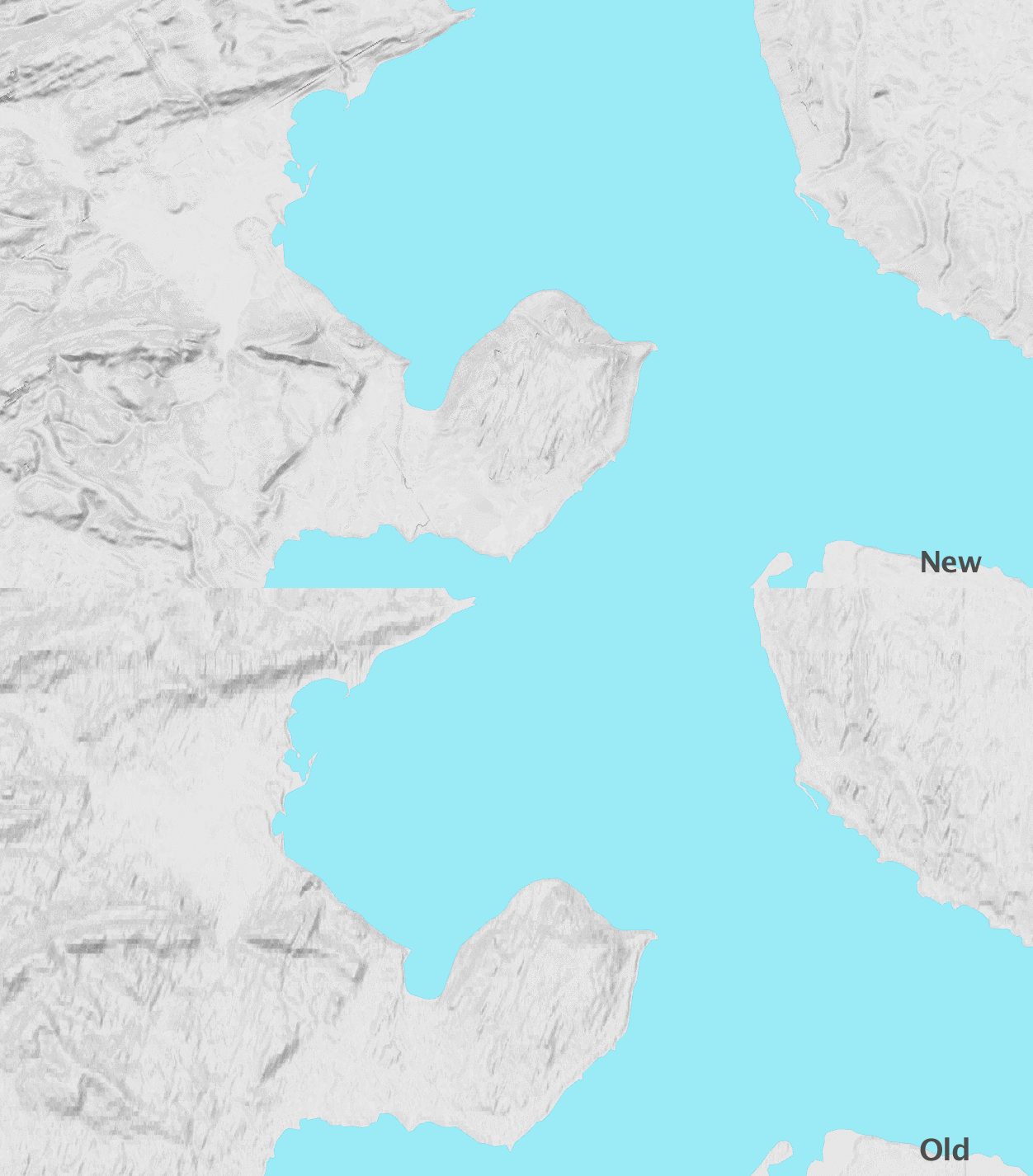
This new coverage comes from governments releasing data they collect as open, accessible data. This allows us to include elevation data at resolutions of better than 5 meters per pixel in some parts of the world. This high resolution data is blended with other sources to offer the best elevation data we can find for any particular part of the Earth.
 Updated terrain data near Lake Taymyr, Russia
We also updated our software to take advantage of modern cloud technology offered by Amazon Web Services. The new system uses AWS Batch, Lambda, and S3 to allow practically unlimited scalability, letting us pre-generate the Terrain Tile dataset for the entire globe in under a week. The software, called Marblecutter, also runs inside a Docker container, letting us prototype and test locally using the exact versions of software that were run in the cloud. Our system uses components from the existing aerial imagery project OpenAerialMap, extending it to support single band DEM images. The updates and improvements to this software are also being used by OpenAerialMap to improve multi-band support. (We’ll discuss this in depth in an upcoming blog post.)
In addition to updating the software and data, we also added support for 512 pixel tiles and buffered tiles at 260 and 516 pixels to the Mapzen Terrain Tiles service. The 512 pixel tiles are useful for higher resolution screens and more efficient rendering of slippy maps while the 516 and 260 pixel tiles are helpful to support more advanced usage in 3D modeling tools or game engines.
If you’re already using Mapzen Terrain Tiles, there’s nothing you need to change. The Mapzen endpoints remain the same:
https://tile.mapzen.com/mapzen/terrain/v1/terrarium/{z}/{x}/{y}.png?api_key=mapzen-xxxxxxx
https://tile.mapzen.com/mapzen/terrain/v1/normal/{z}/{x}/{y}.png?api_key=mapzen-xxxxxxx
https://tile.mapzen.com/mapzen/terrain/v1/geotiff/{z}/{x}/{y}.tif?api_key=mapzen-xxxxxxx
https://tile.mapzen.com/mapzen/terrain/v1/skadi/{N|S}{y}/{N|S}{y}{E|W}{x}.hgt.gz?api_key=mapzen-xxxxxxx
You can access the updated Terrain Tiles via the same Amazon S3 endpoints:
elevation-tiles-prod/terrarium/{z}/{x}/{y}.png
elevation-tiles-prod/normal/{z}/{x}/{y}.png
elevation-tiles-prod/geotiff/{z}/{x}/{y}.tif
elevation-tiles-prod/skadi/{N|S}{y}/{N|S}{y}{E|W}{x}.hgt.gz
You can get more information about each format in Mapzen documentation and the Amazon Public Datasets page.
The updated tiles are already being used for hillshading in the Walkabout basemap style. Check them out! (If you see any data problems, please file an issue).