Mapzen is excited to introduce Mobility Explorer: a new tool for querying and visualizing Transitland data and Mapzen Mobility services. Mobility Explorer makes it easy to see relationships between transit datasets, analyze travel options, and share your discoveries.
Mobility Explorer is built for developers of maps and apps, public policy advocates and planning experts, transit nerds, and anyone who is curious about exploring transit data from the top down, bottom up, or starting anywhere in between. Our goal is to make existing transit data more accessible by presenting it visually, and sharing it more readily.
There are so many things you can do with Mobility Explorer. Even if you aren’t setting out to create a map or app, you might want to understand the connections between transit systems in your own neighborhood. Perhaps you work for a transit operator, and want to visually verify the data Transitland has for your agency. You might be visting a neighborhood in a new city and want to see all of the routes that pass through it, and where you can go from your new ‘hood. Or, maybe you are looking to get creative and develop a new web app, but want to see what data exists in the Transitland Datastore before you begin.
Mobility Explorer provides an approachable way to query for and immediately visualize the data. Search for points of interest in the search box, or drop a pin on the map to set your bounding box, then use the Transitland Data buttons to view the stops, routes, and operators serving the area. Each option you select is saved as part of the URL, creating a shareable link that leads to the view of the data that you’ve created.
Connections between datasets
One goal for the Explorer is to highlight the connections that exist between transit datasets. Let’s look at an example; say you are in an Empire State of Mind, and feel like learning more about transit in New York City. You can use the Explorer to zoom in on the Richmond Hill neighborhood and click the SHOW STOPS button to see what’s there.
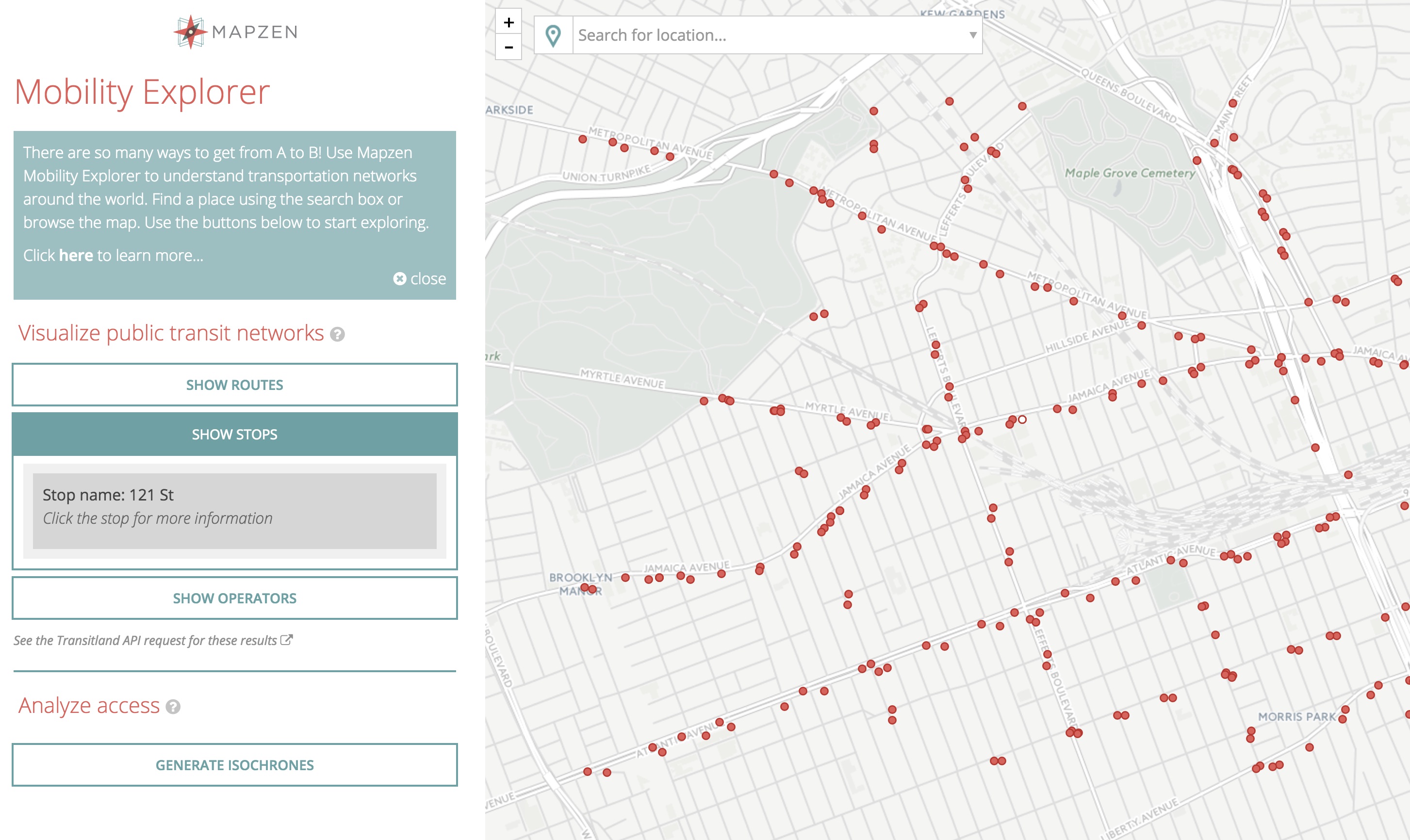
You can get information on a single stop by hovering over the stops to view their name, and click them to get detailed information.
After clicking the 121st Street stop, you see that it is served by the JZ line. Once you select the route you can opt to view all of the stops —it’s not 99 stops, but it visits quite a few.
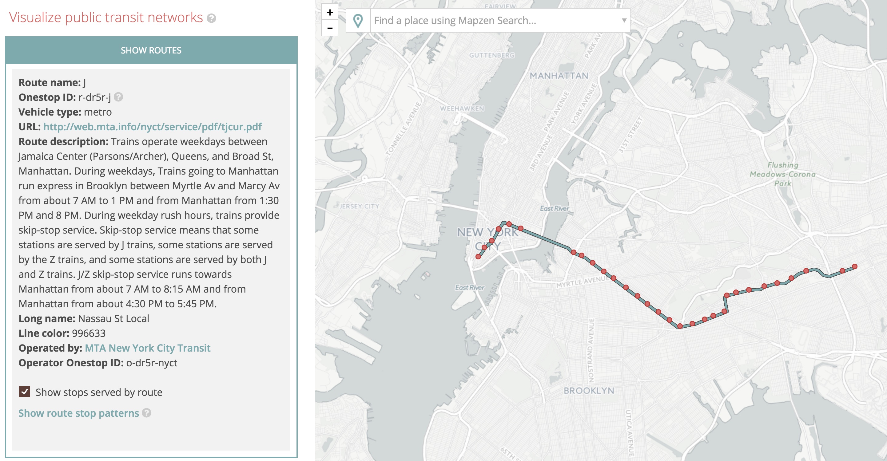
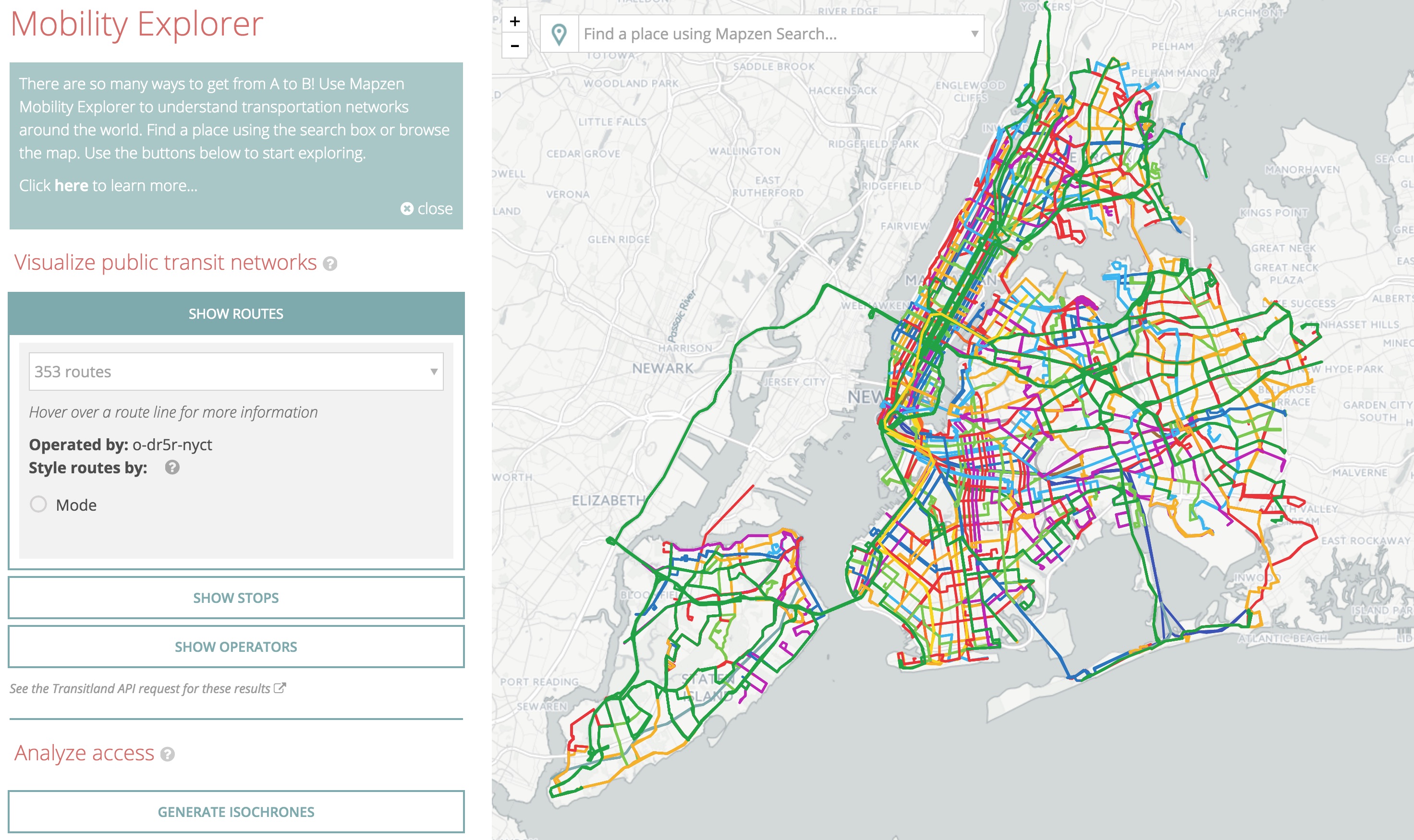
You can also see that this route is operated by MTA. By clicking on the operator name, you are taken to a view of the operator’s entire service area. From there, you can choose to view all stops and routes served by the operator.
Mobility Explorer with isochrones
Another goal for the Explorer is to use Mapzen Mobility services to analyze and understand travel options beyond fixed-route transit. And so, Explorer also presents a brand-new service: the Mapzen Isochrone service. Isochrones, often referred to as “sheds”, tell you where you can travel from a particular point at various time intervals.
Let’s say you are a city boy, born and raised in South Detroit. You’re interested in taking a midnight train going anywhere, but you’ve only got an hour. Just how far could you get? Head over to the Explorer and drop a pin (or enter your search terms) to find out! You can then choose to view isochrones for walking, biking, driving, or transit. The transit option also allows you to choose the time of departure, since the distance you can travel will vary with changes in service throughout the day. So, here’s the transit isochrone for this point in South Detroit (er, Windsor, Ontario) with the departure time set for midnight:
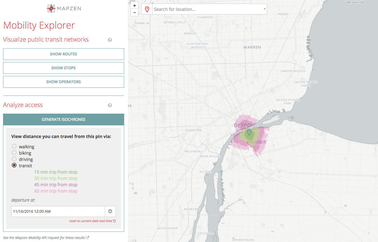
Looks like you can’t get too far in an hour at this time of night, but now that you can visualize this on a map and share your map view using its unique URL, you could start to lobby for improved transit options—so don’t stop believin’!
Try out Mobility Explorer
We hope Mobility Explorer helps you discern the richness of data in Transitland and highlights the connections between routes and stops of different operators.
As we expand our range of Mapzen Mobility services, you’ll be able to use them through both an API and through Mobility Explorer. We can’t wait to see what we learn together!
Try Mobility Explorer at https://mapzen.com/mobility/explorer.
Happy Exploring!
Preview image: “Textile, Traffic, 1983” by Jurgen Lehl, via Cooper Hewitt
