A few months ago we asked ourselves: how could we celebrate walking? Today we introduce Mapzen’s latest cartography: Walkabout.
Walkabout features walking paths & hiking trails early, emphasizes outdoor attractions with bright green-blue icons, and shows where the ups and downs are with hill shading. From a morning jog to a slow stroll with friends, in the city to the backcountry, Walkabout evokes the places we’ve played outdoors and inspires us to “get outside”.
Walkabout joins Mapzen’s other house styles: Bubble Wrap, Refill, Zinc, and Cinnabar and is available immediately in default, more labels, and no labels basemap versions.
Explore Walkabout below and scroll down for a visual tour of this signature cartography.
Walkabout San Francisco. View full screen ➹
Icons
We designed a completely new set of icons for Walkabout focusing on crisp details in a 18 pixel square grid. Outdoor related icons are emphasized with a blue-green gradient color badge and a white glyph with dark brown highlights.
This treatment allows Walkabout icons to figure above the basemap cartography drawing attention to features like parks, beaches, ski resorts, campgrounds, picnic sites, restrooms, trailheads, peaks, waterfalls, dog parks, and outdoor supply stores.
We’re not just interested in the destination, though. Sometimes it’s about the journey. Or maybe you get hurt and need help. Or maybe you’re more interesting in urban walking. These kinds of places feature a dash of color on a muted background and include train stations, hospitals, zoos, museums, and tourist attractions.
All other features are drawn in a muted grey, from restaurants to sports pitches.
Can you spot all the custom icons in each scene below?
![]()
Icons on the map
All images below click thru to full screen interactive maps.
![]()
![]()
![]()
![]()
![]()
![]()
![]()
![]()
![]()
![]()
![]()
![]()
![]()
![]()
![]()
![]()
![]()
![]()
![]()
![]()
![]()
![]()
![]()
![]()
![]()
![]()
![]()
![]()
![]()
![]()
Hill shading

The pencil drawing at right is the sphere map image that powers hill shading in Walkabout.
The map below shows how Tangram uses the sphere map image and elevation normals to generate hill shading for Walkabout. Water is drawn with a solid bright blue to contrast with the grayscale terrain to provide the base upon which all other map layers sit. This feature is powered by Mapzen’s global elevation tiles.
Walkabout San Francisco. View full screen ➹
Then we colorize the hill shading for green, brown and other park & landuse areas:
Walkabout San Francisco. View full screen ➹
Adding trails and roads, with early trail visibility powered by v0.10 vector tile changes:
Walkabout San Francisco. View full screen ➹
All together now, around the world
All images below click thru to full screen interactive maps.
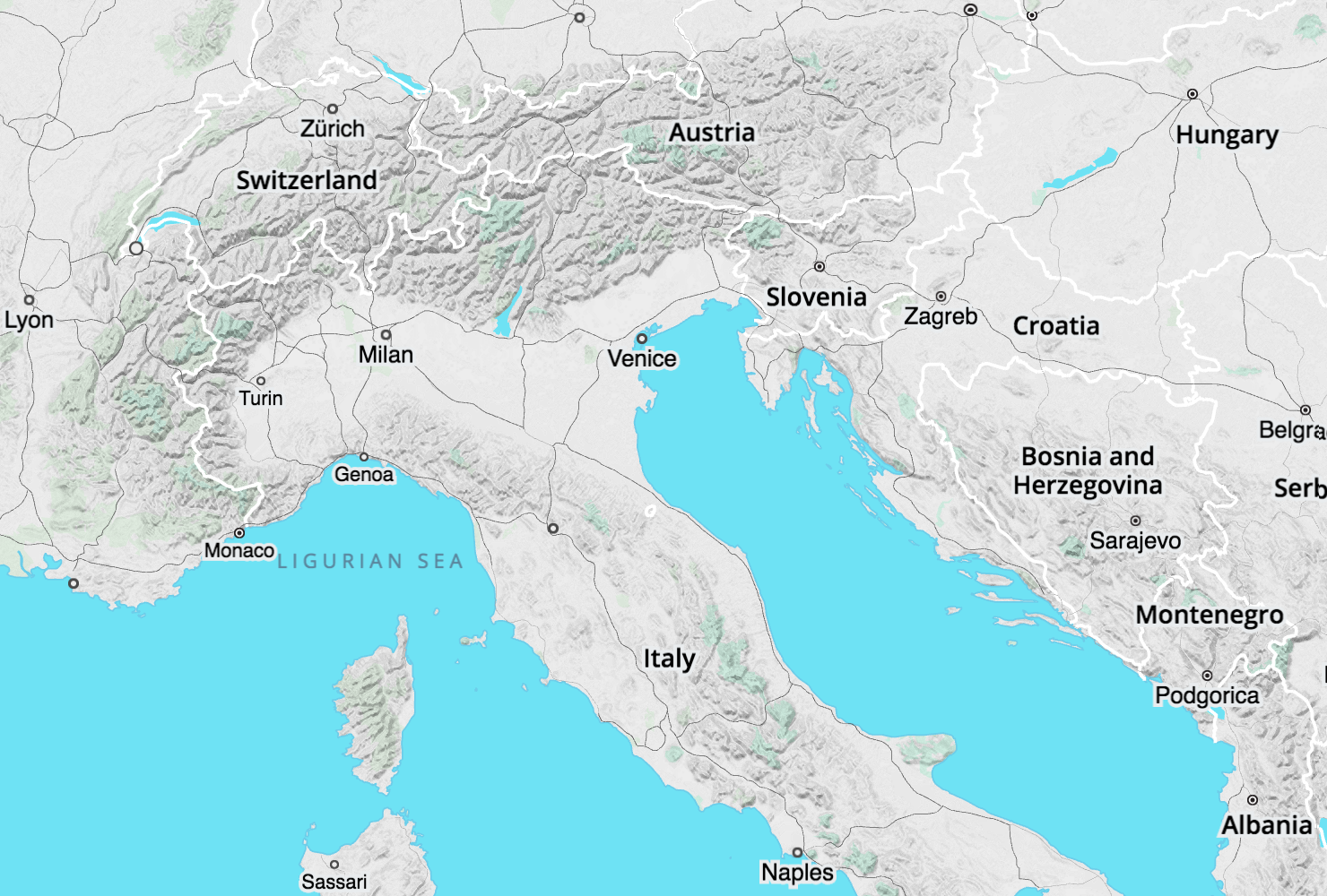
Zoom 6: European Alps over to the Carpathian Mountains, and the Appennini in Italy.
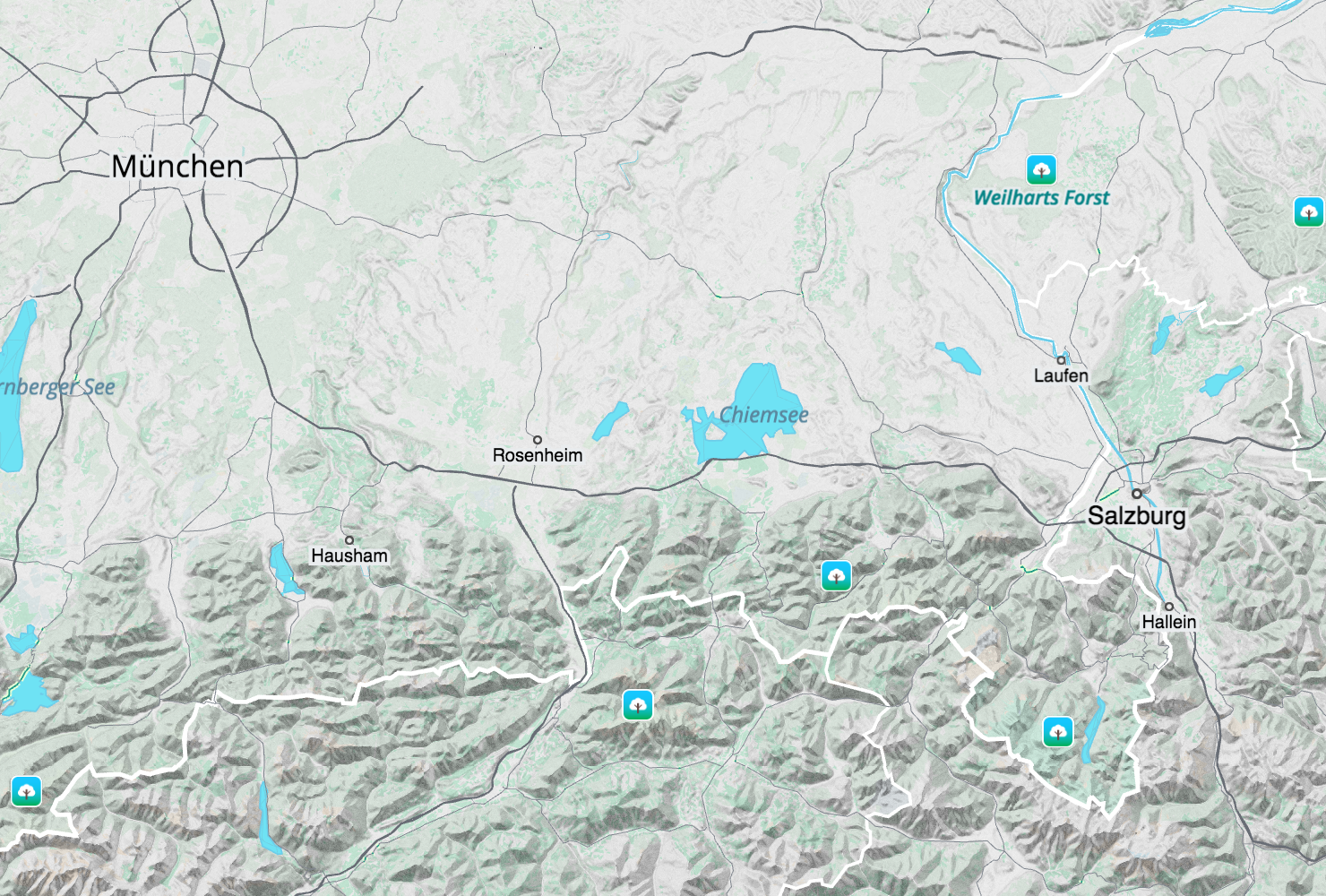
Zoom 9: Munich, Germany and Salzburg, Austria mark the Alp’s northern extent.
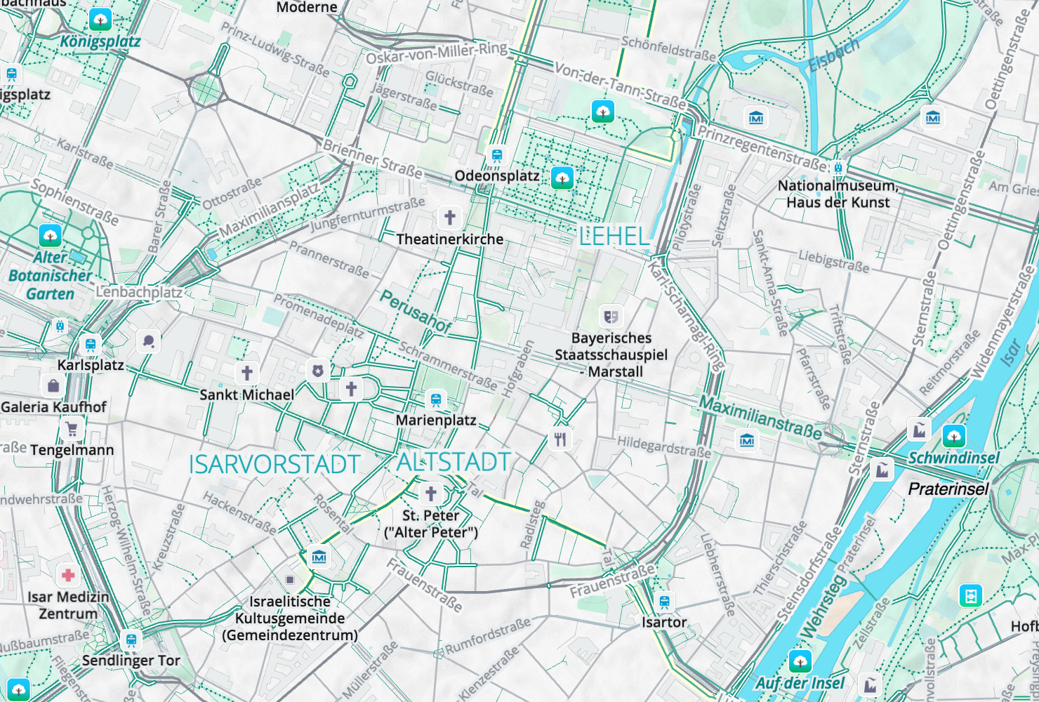
Zoom 12: Outdoor recreation options abound in Munich with the English Garden on the western banks of the Isar. Major landmarks like train stations are called out with blue icons and a similar blue is used for neighbourhood labels.

Zoom 15: Downtown stretching from the central train station through the old city and onto the Isar river. Shopping galleries, parks, cathedrals, beerhalls, and other major attractions are featured. Museums are blue and hospitals are red. Note the extensive walking network and pedestrian-only zone in the old city!
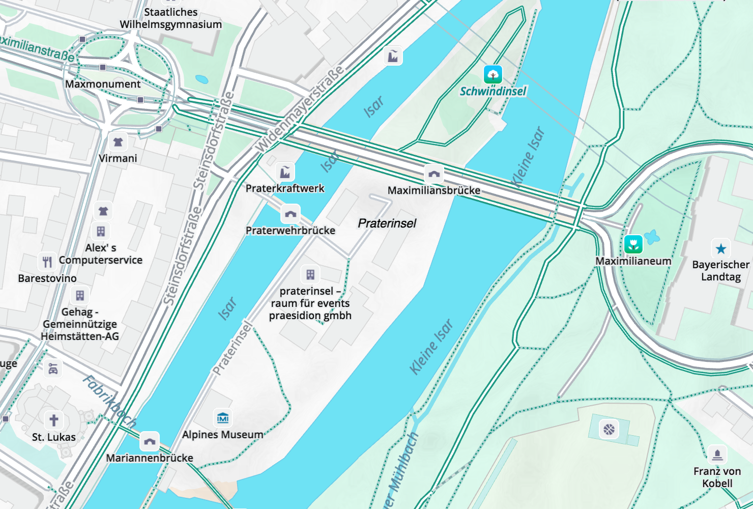
Zoom 17: All shops, restaurants, and other attractions are now visible with a muted grey icon treatment. The Alpines Museum on the Praterinsel Island is called out as urban walking attraction.
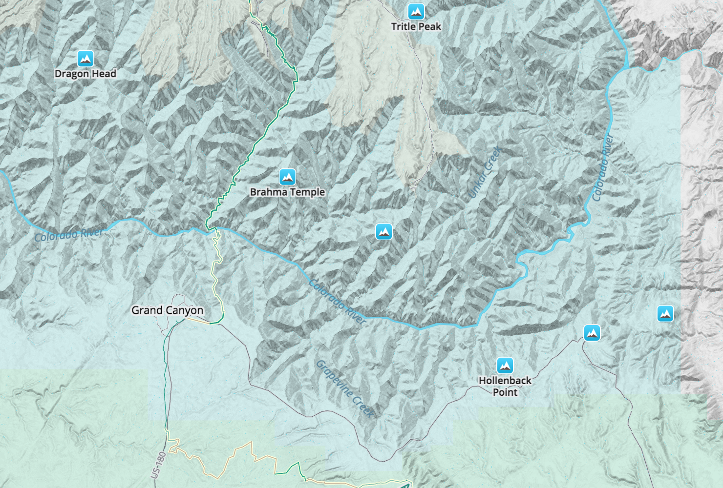
Zoom 13: Switching continents, we’re now at the Grand Canyon with the Bright Angel Trail leading from the village down, down, down to the Colorado River with Cheops Pyramid and Zoroaster Temple north of the river.

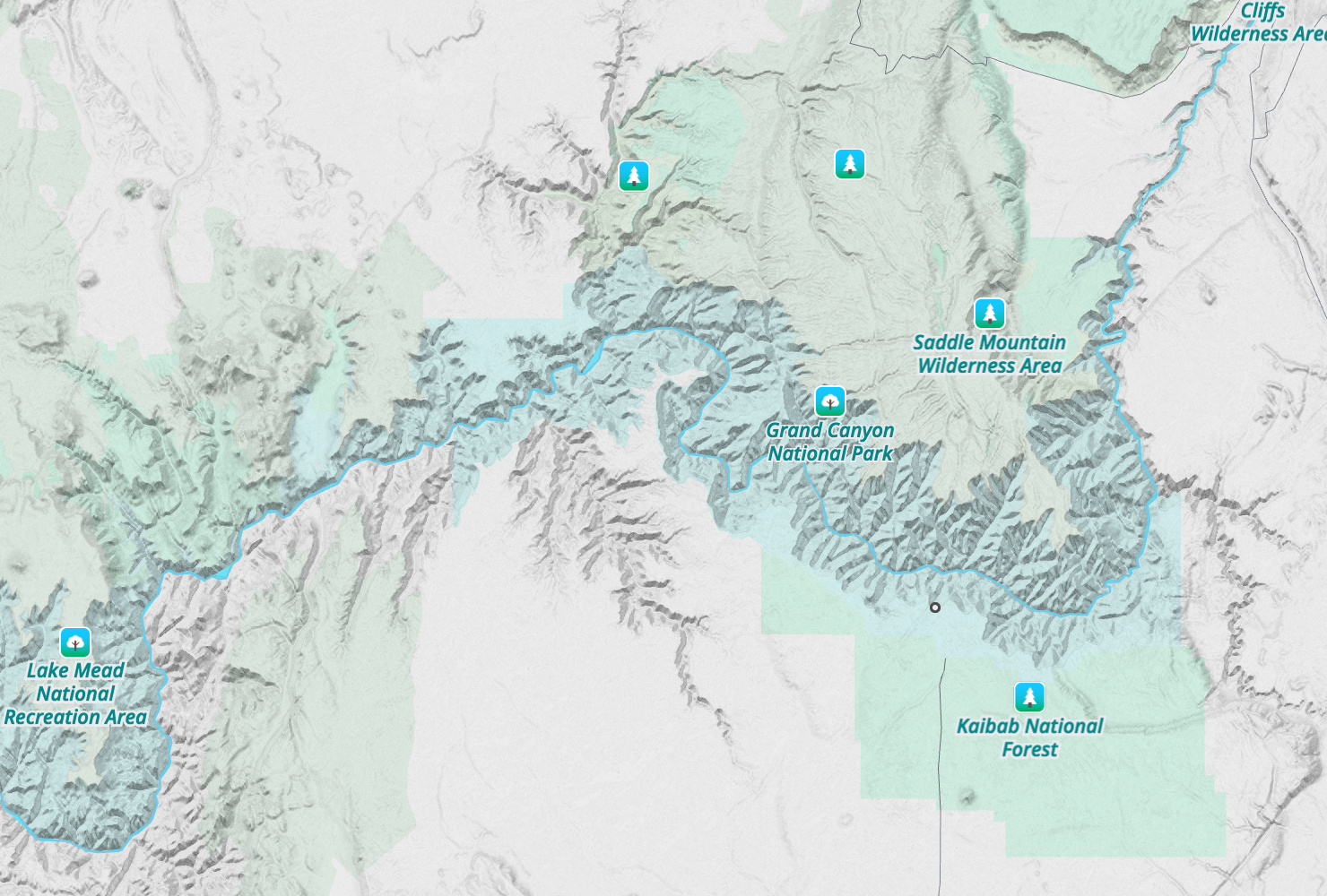
Zoom 11: Stepping back, we see the full extent of the canyon.
Zoom 9: The mighty Colorado bracketed by Lake Powell upstream and Lake Mead downstream.
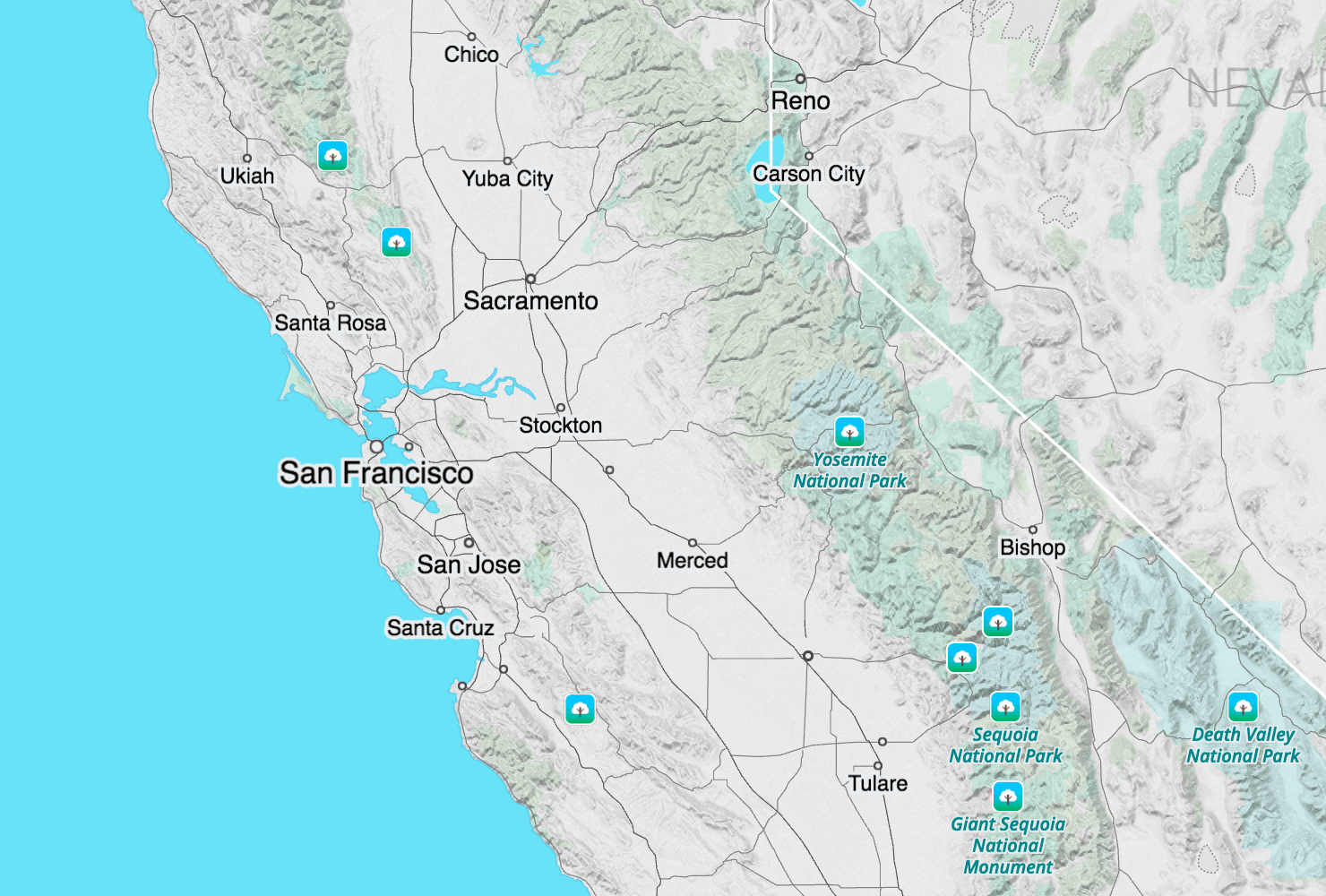
Zoom 7: Panning over to California we see the snow crested Sierra Nevada, the Central Valley, and San Francisco sitting on the Pacific Ocean.
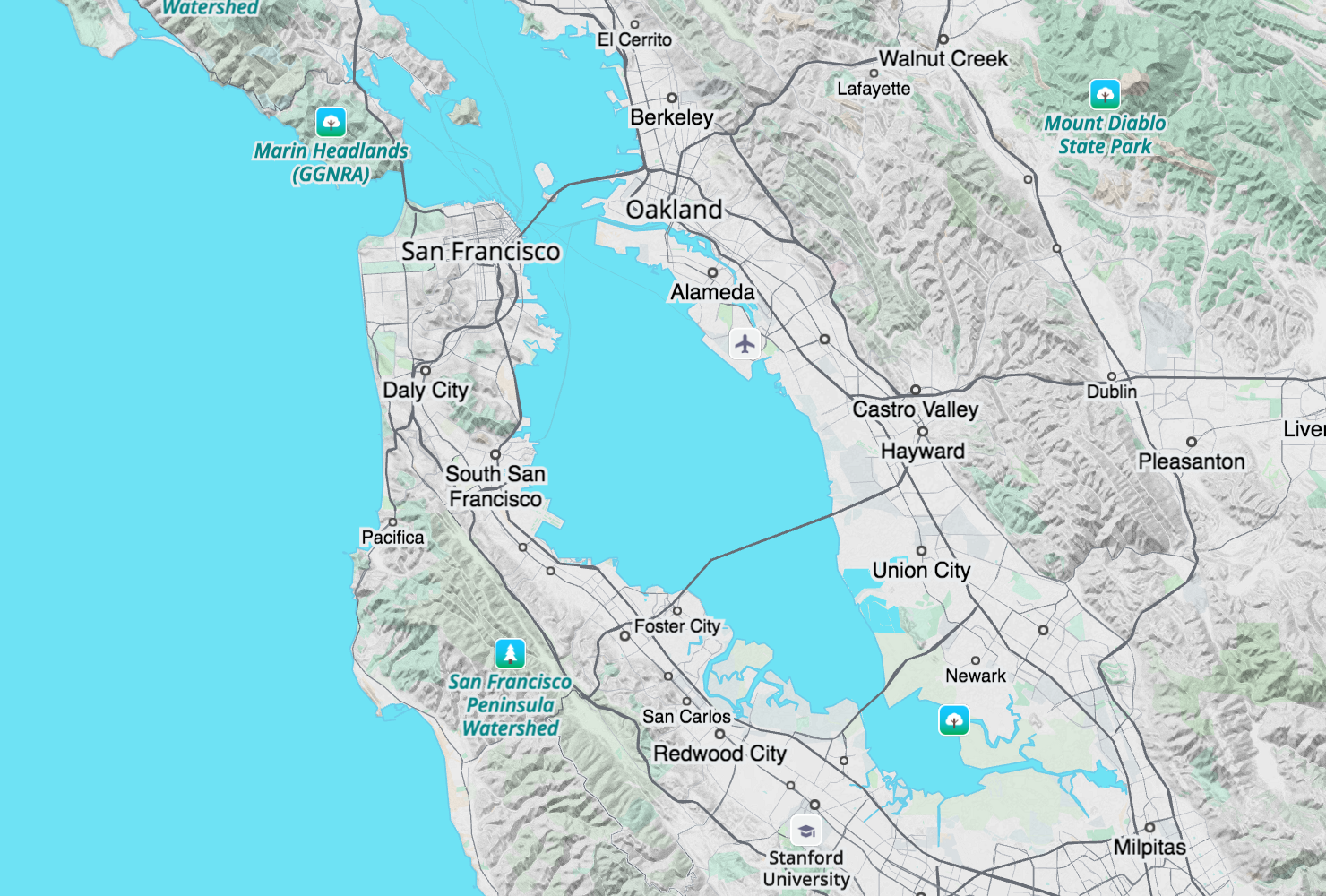
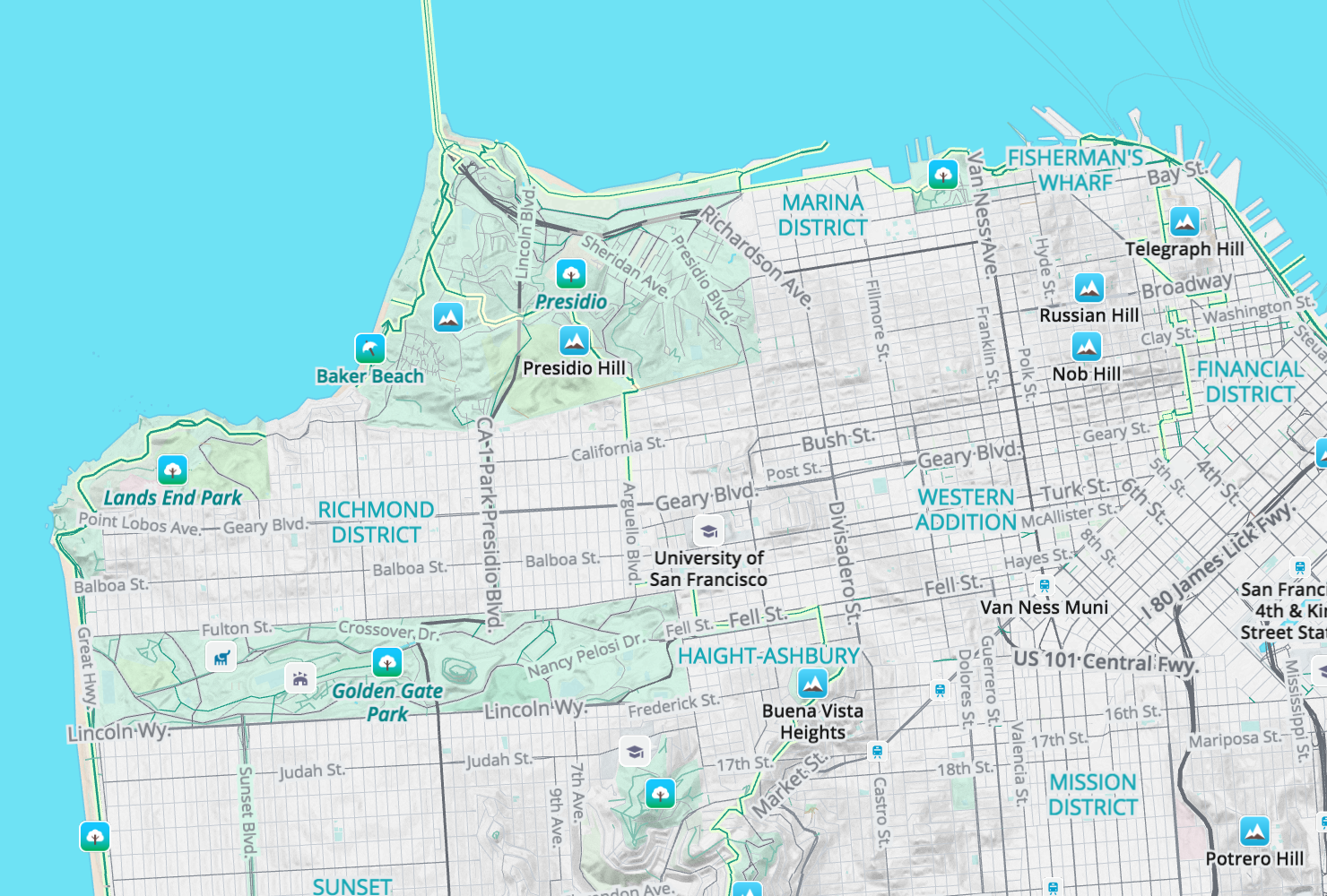
Zoom 10: Let’s spend some time in the San Francisco Bay Area, with Mt. Diablo in the east.
Zoom 13: From Bay to Breakers and a few hills in between San Francisco offers the Bay trail, the Barbary Coast trail, Bay Ridge trail, and the California Coastal trail in green with a yellow highlight that in later zooms helps you stay on route thru areas of dense footpaths.
Zoom 15: Golden Gate Park was founded in the 1870s and rivals New York’s Central Park in total area and attractions with bike paths and foot trails connecting Ocean Beach with the urban city scape and famous museums like the De Young.
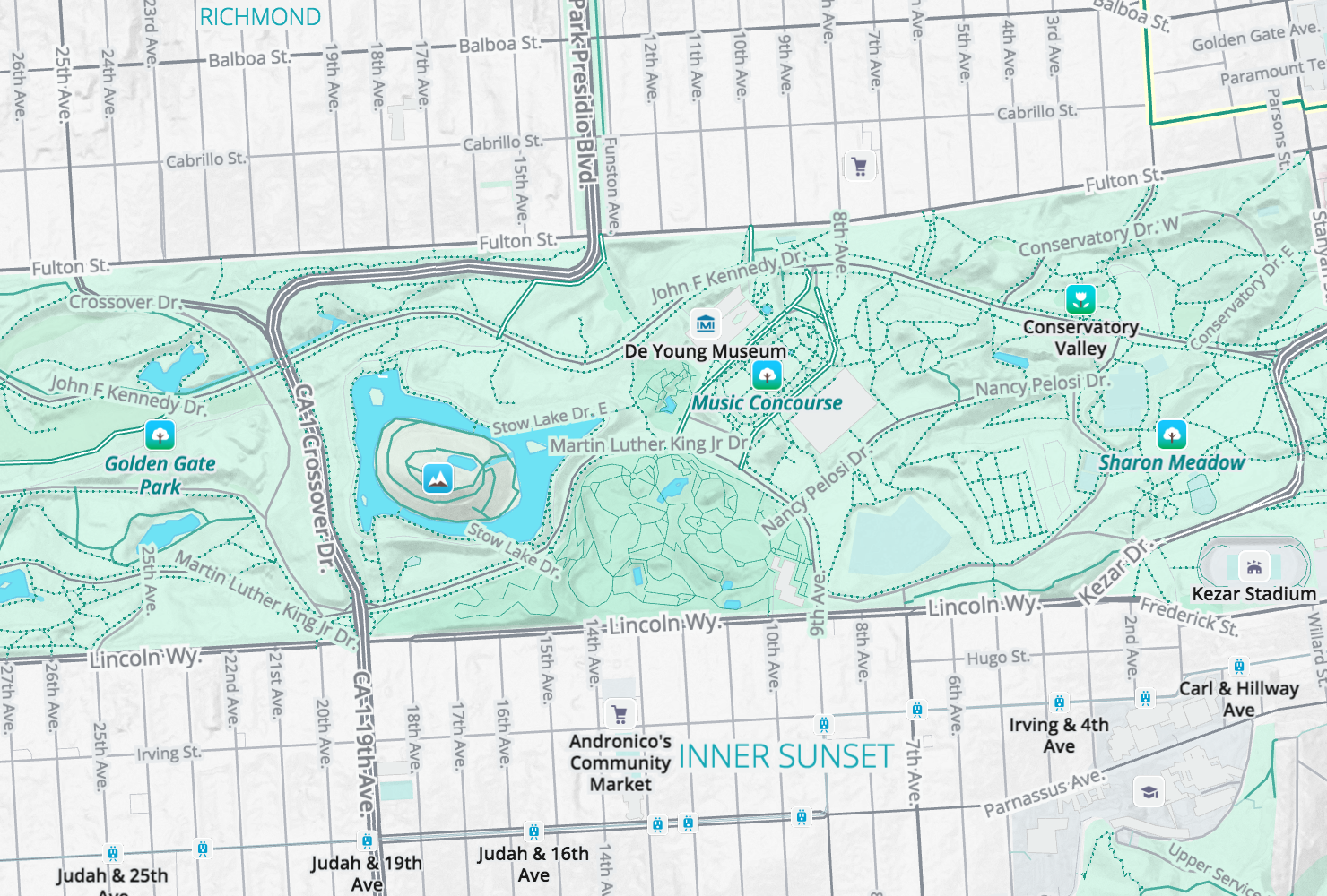
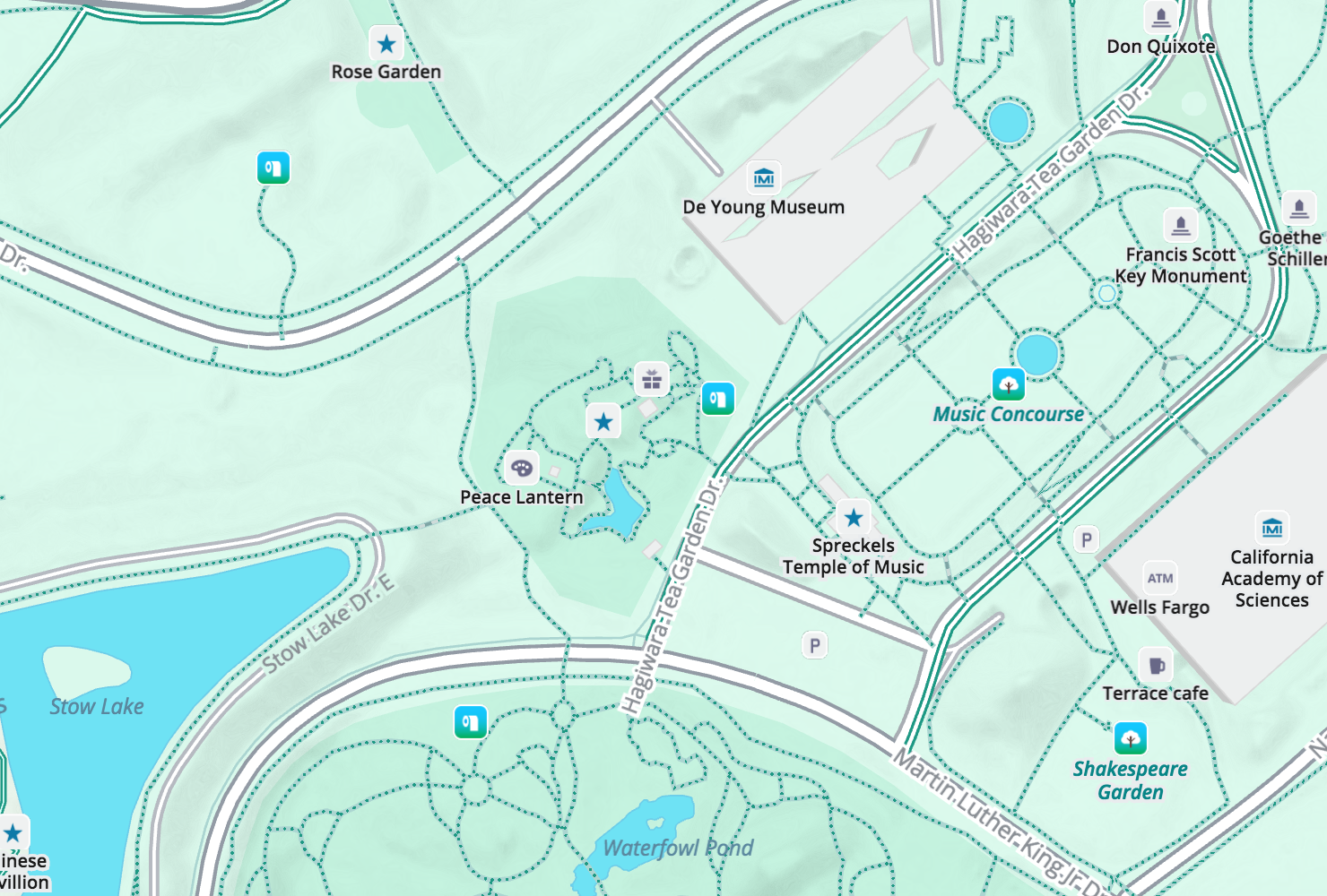
Zoom 17: The heart of the park around the De Young Museum, California Academy of Sciences, and Stowe Lake is full of gardens, picnic spots, and restrooms.
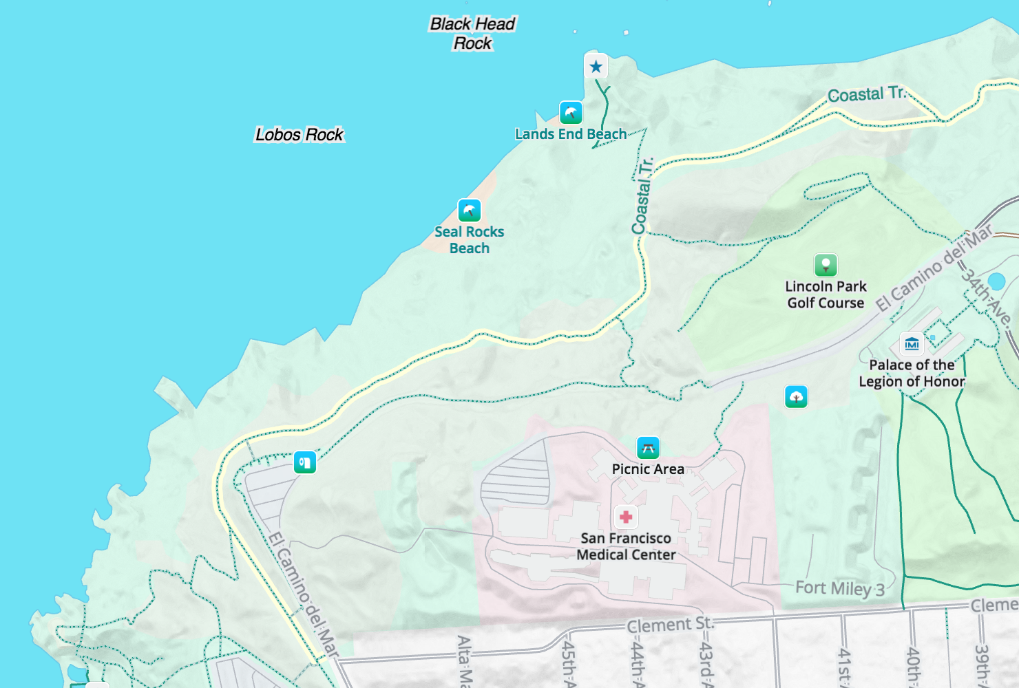
Zoom 17: Panning over to Lands End just north of Golden Gate Park in San Francisco we find museums, golf courses, hospitals, picnic spots, scenic vistas, beaches, and more toilets all connected by the California Coastal trail.
Zoom 17: At the southern end of Ocean Beach the San Francisco Zoo walks visitors from the Lemur Forest to Grizzly Gulch.
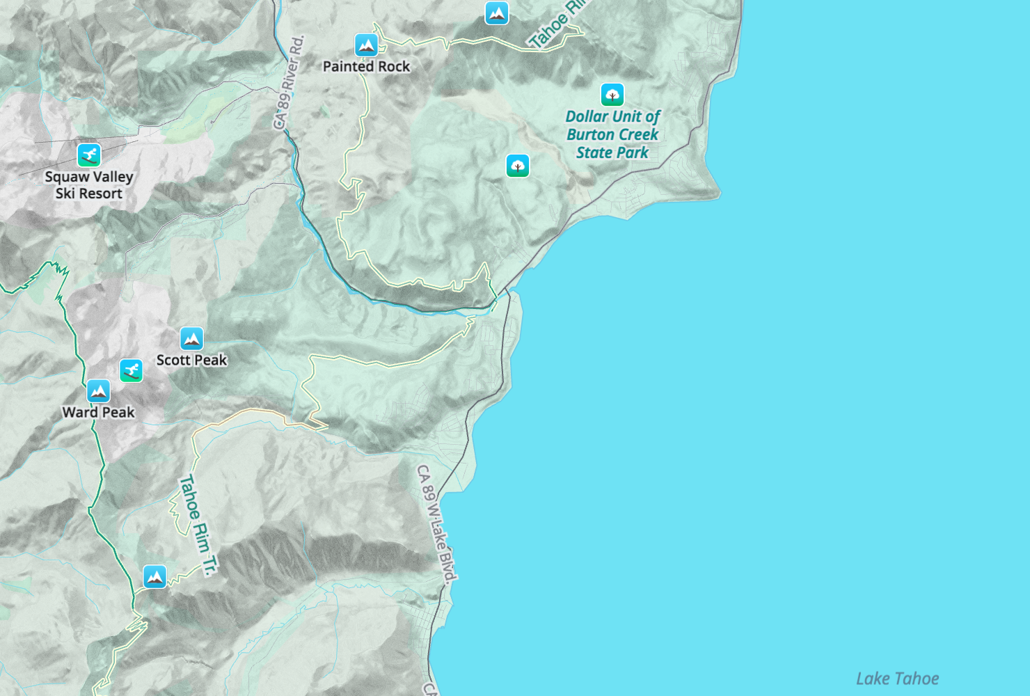
Zoom 12: Mark Twain once famously quipped, “the coldest winter I ever spent was my summer in San Francisco, but when the going got rough I headed to North Star.” Here you can see Squaw Valley and other ski resorts with the Pacific Crest and Tahoe Rim trails nearby.
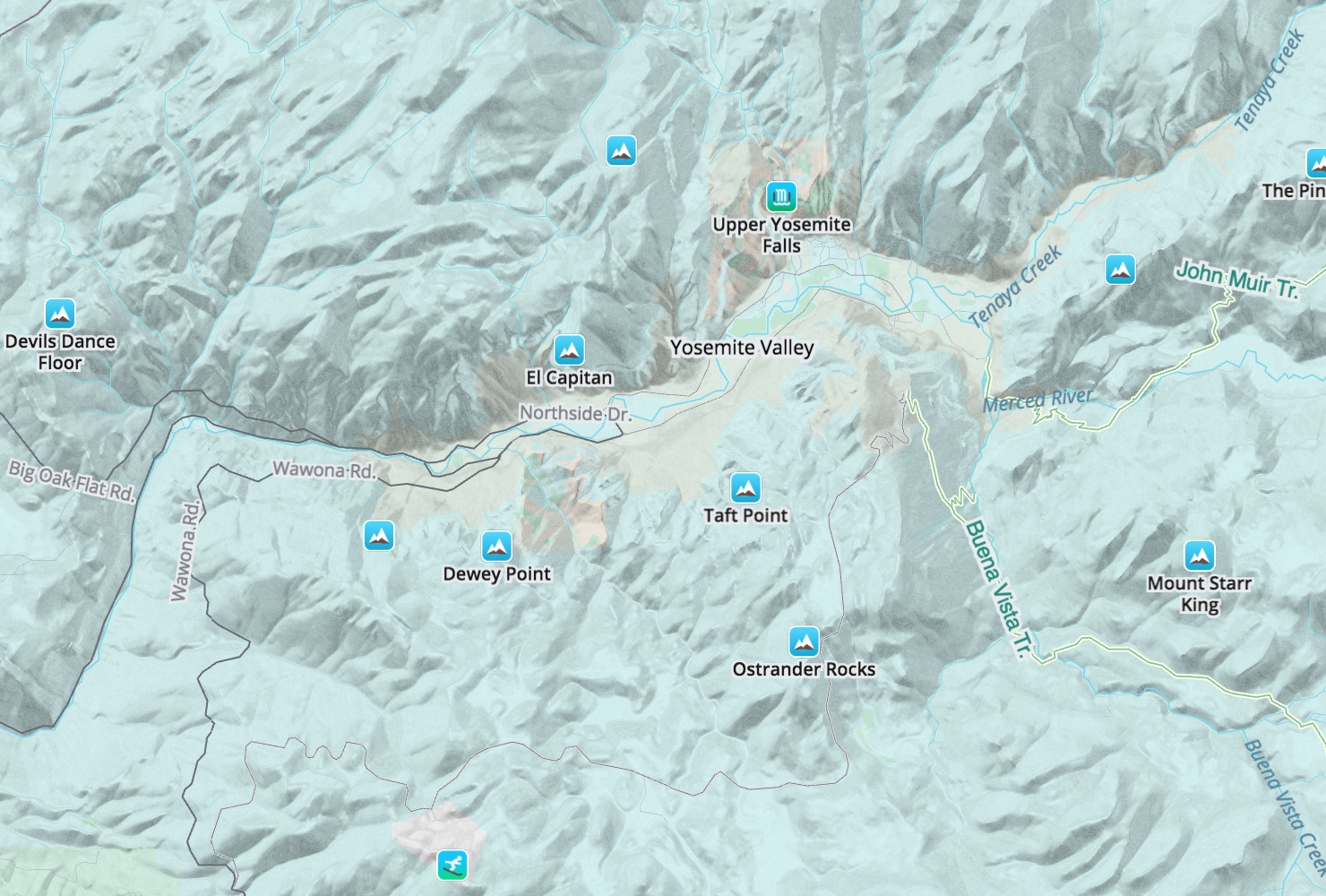
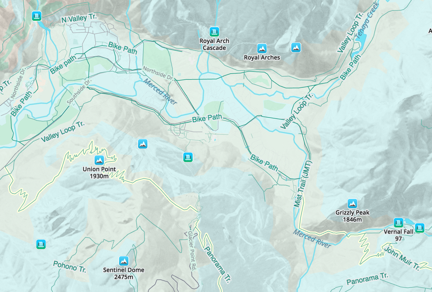
Zoom 12: Yosemite is beautiful year round with El Capitan and the falls dominating the valley. On the east side of the valley the John Muir trail wraps behind Half Dome and heads up to the sierra crest.
Zoom 13: Stepping in for a closer view more trails are shown along with attractions like Bridalveil Falls, Vernal Fall, and Artists Point.
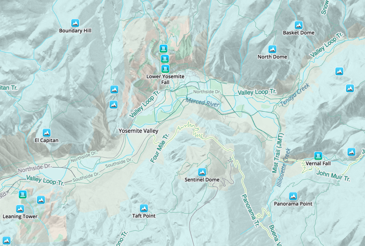
Zoom 14: A closer look at Yosemite valley.
Zoom 11: The Pacific Crest and John Muir trails are the “interstate” system of the backcountry and Walkabout shows them along side the highways leading to their trailheads.

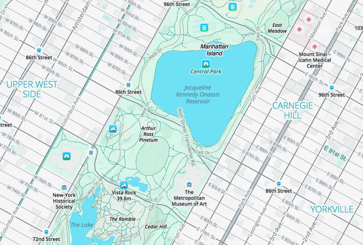
Zoom 15: Central Park in New York city.
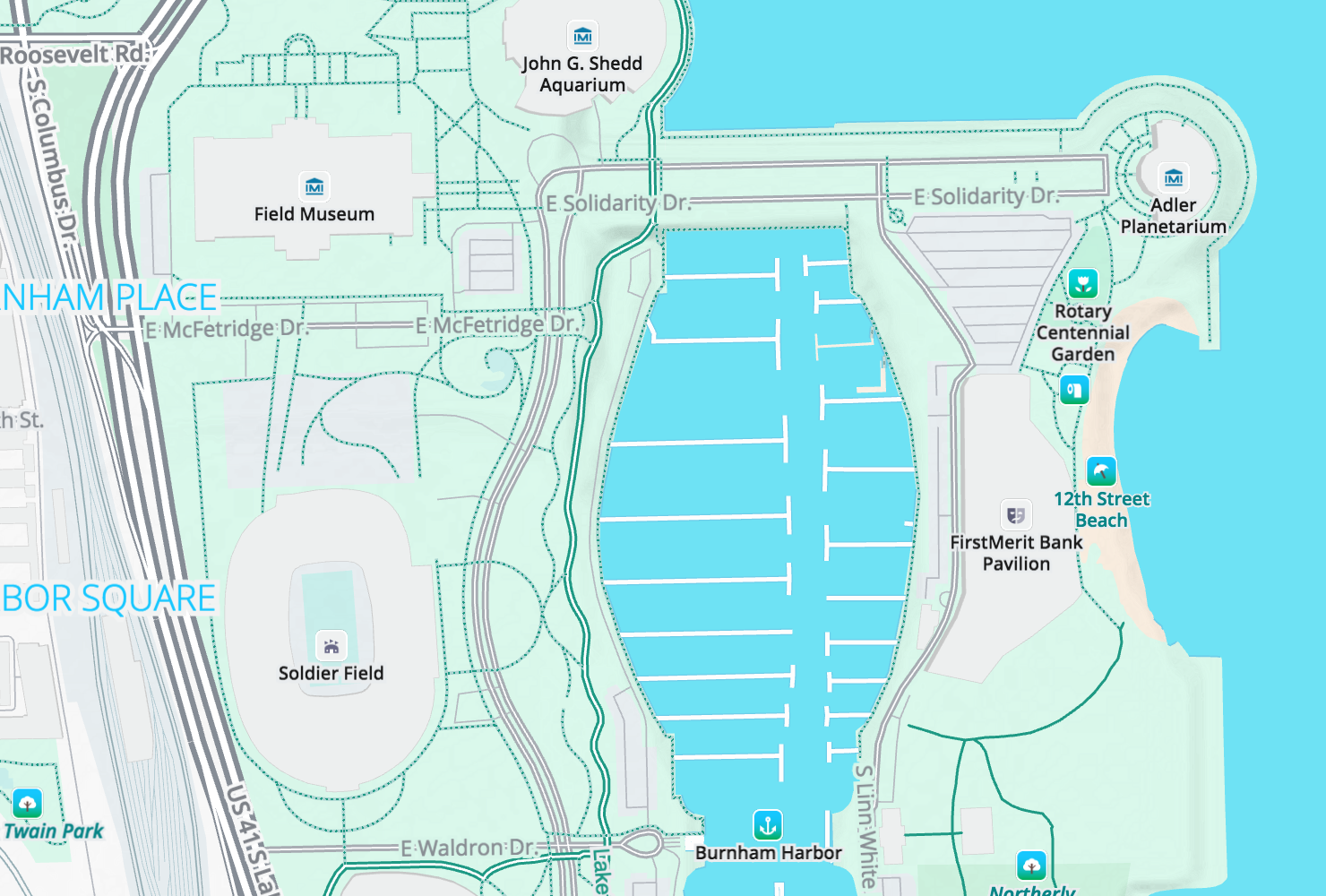
Zoom 16: Chicago’s lakeshore with the Field Museum.
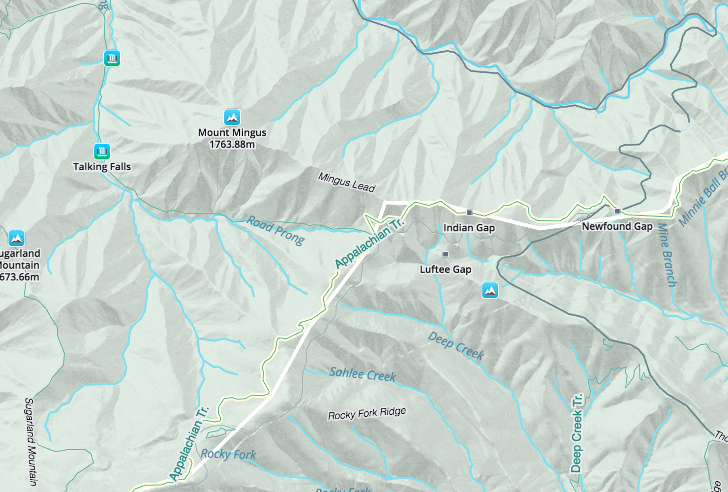
Zoom 14: Newfound Gap on the Apalachian Trail in Great Smokey Mountains National Park. Ridges and creeks are named.
Zoom 11: Honolulu, Hawaii.

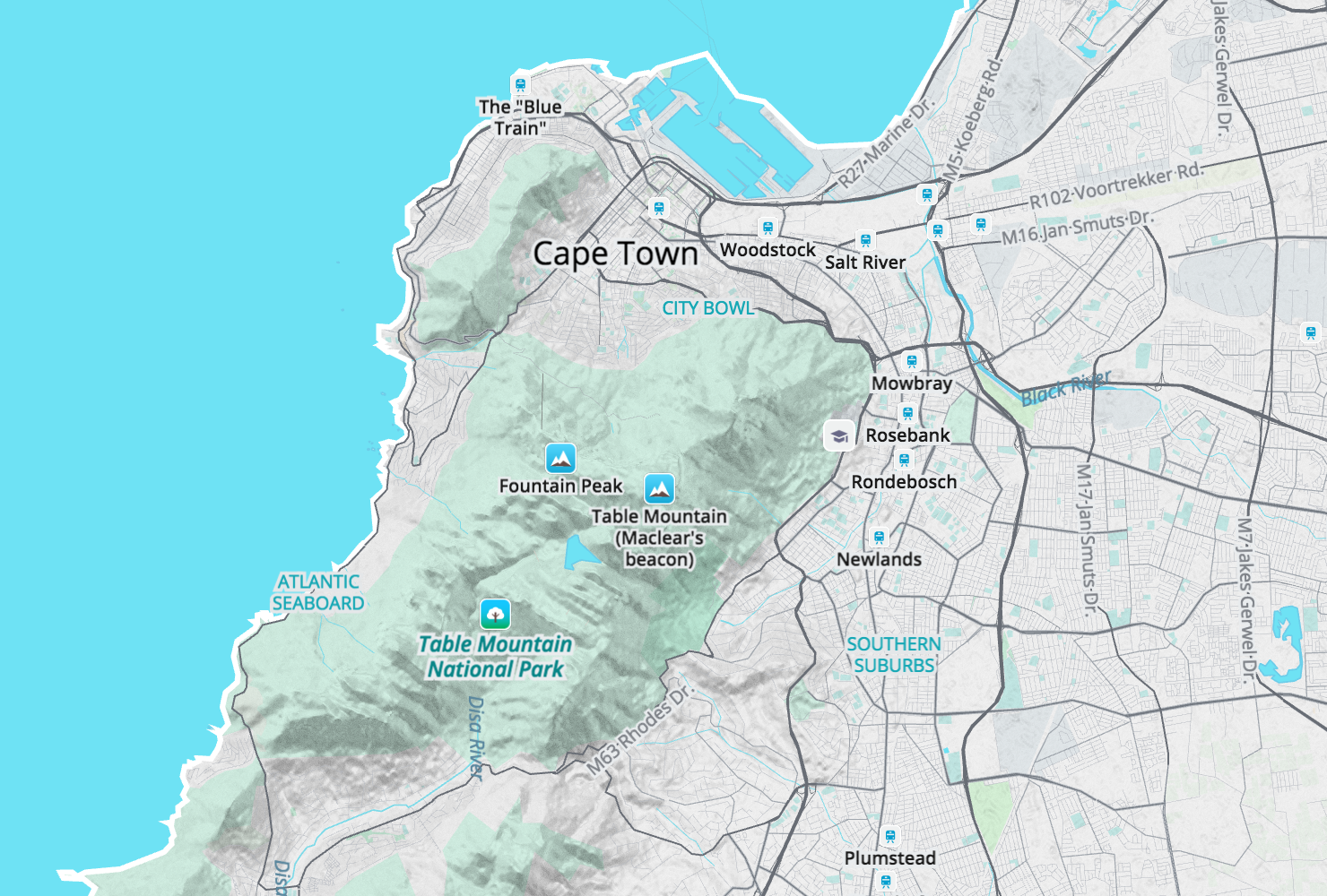
Zoom 12: Table Mountain and Cape Town, South Africa.
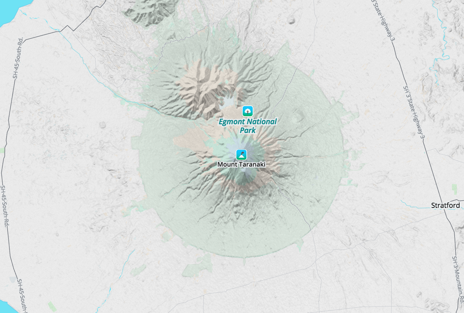
Zoom 11: Mt. Taranaki in New Zealand’s Egmont National Park.
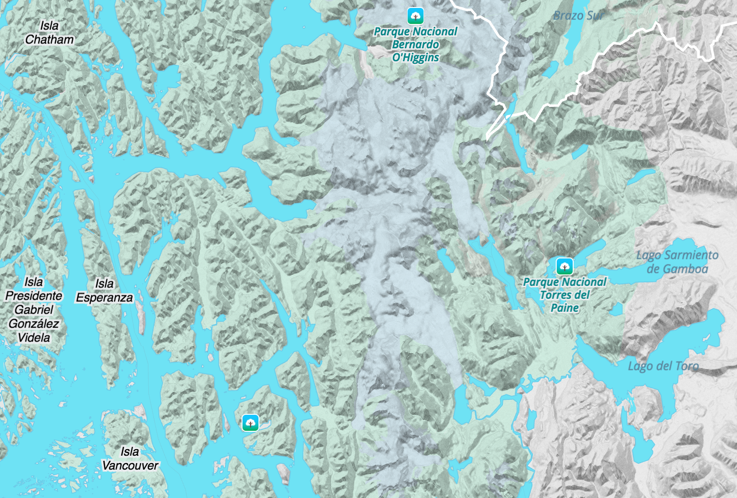
Zoom 9: Torres del Paine National Park in southern Chile.
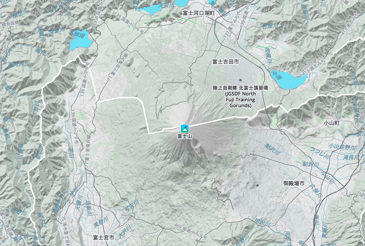
Zoom 11: Mount Fuji in Japan.
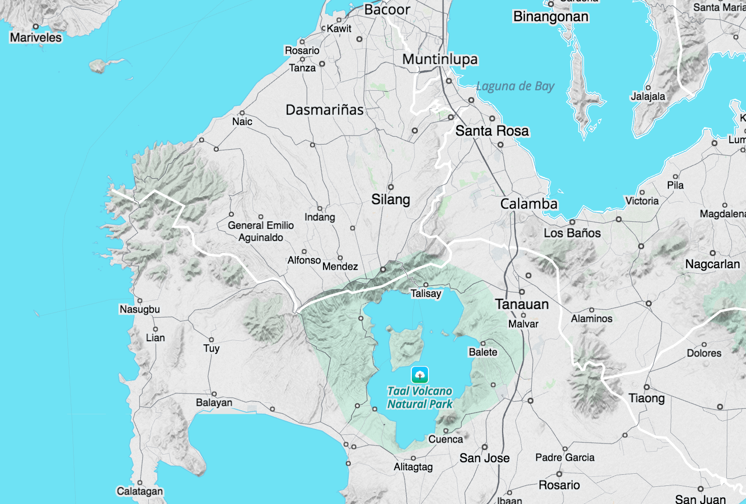
Zoom 10: Taal valcano south of Manila, Philippines.
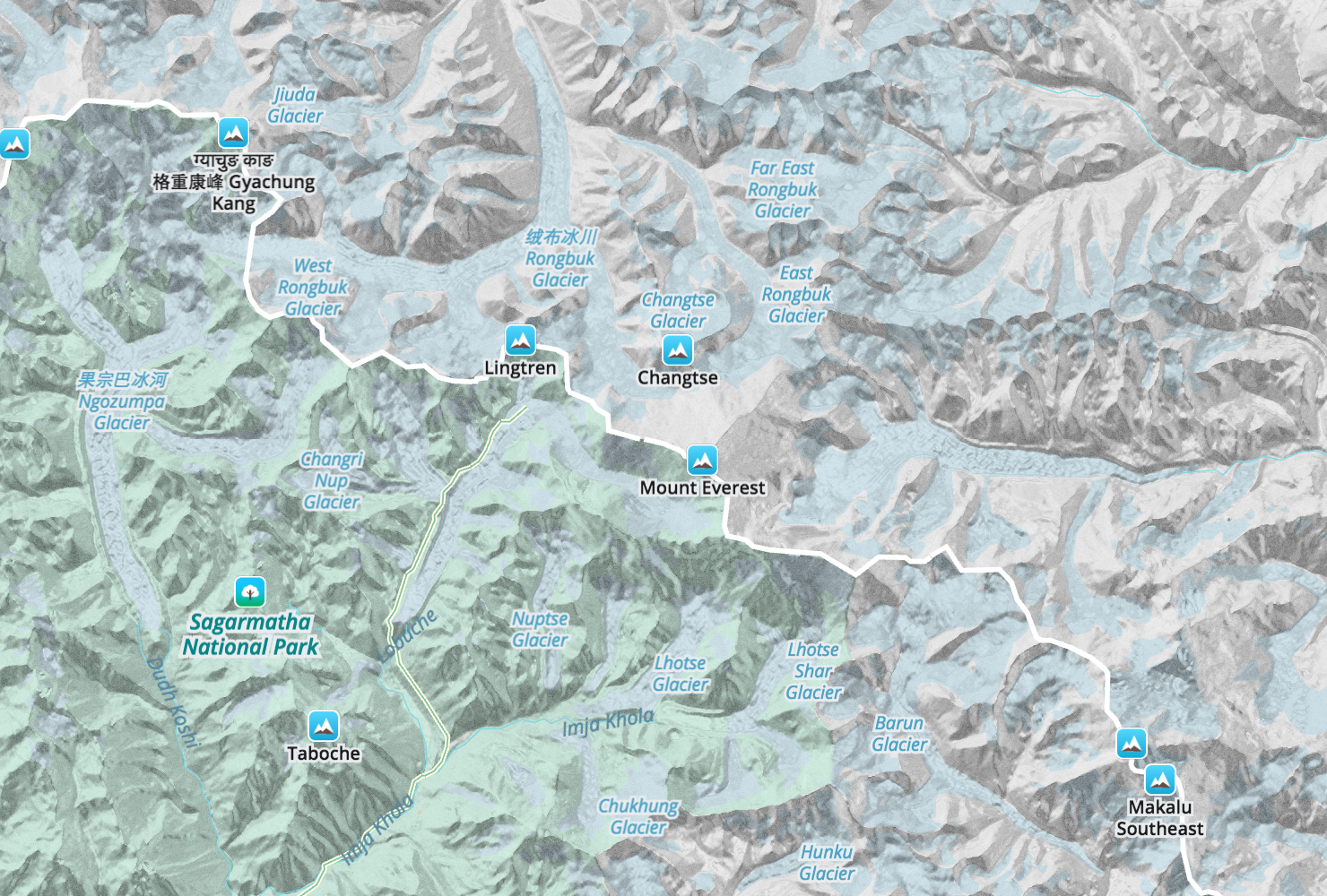
Zoom 11: Mount Everest surrounded by glaciers.
But enough of the walk thru. Please take a Walkabout and get outside!

