Posts tagged: data


Get more for less with 512 pixel tiles
Same Mapzen basemaps, now with 75% fewer Flex calories. Want dessert? Lick the icing off our new 260 and 516 pixel buffered terrain tiles!
Statoids, Mesoshapes, and Who's On First

Check out our recent additions to the Who's On First gazetteer, including our partnership with Statoids!
Welcoming Mapzen Places and Libpostal to Mapzen Flex

Who's On First data is getting easier to use as Mapzen Places comes to Flex, along with Libpostal!
Increasing Name Translations in Who's On First

Outlining and visualizing the work we've done to increase name translations in the Who's On First gazetteer.

Redesigning and Rebuilding the Who's On First website
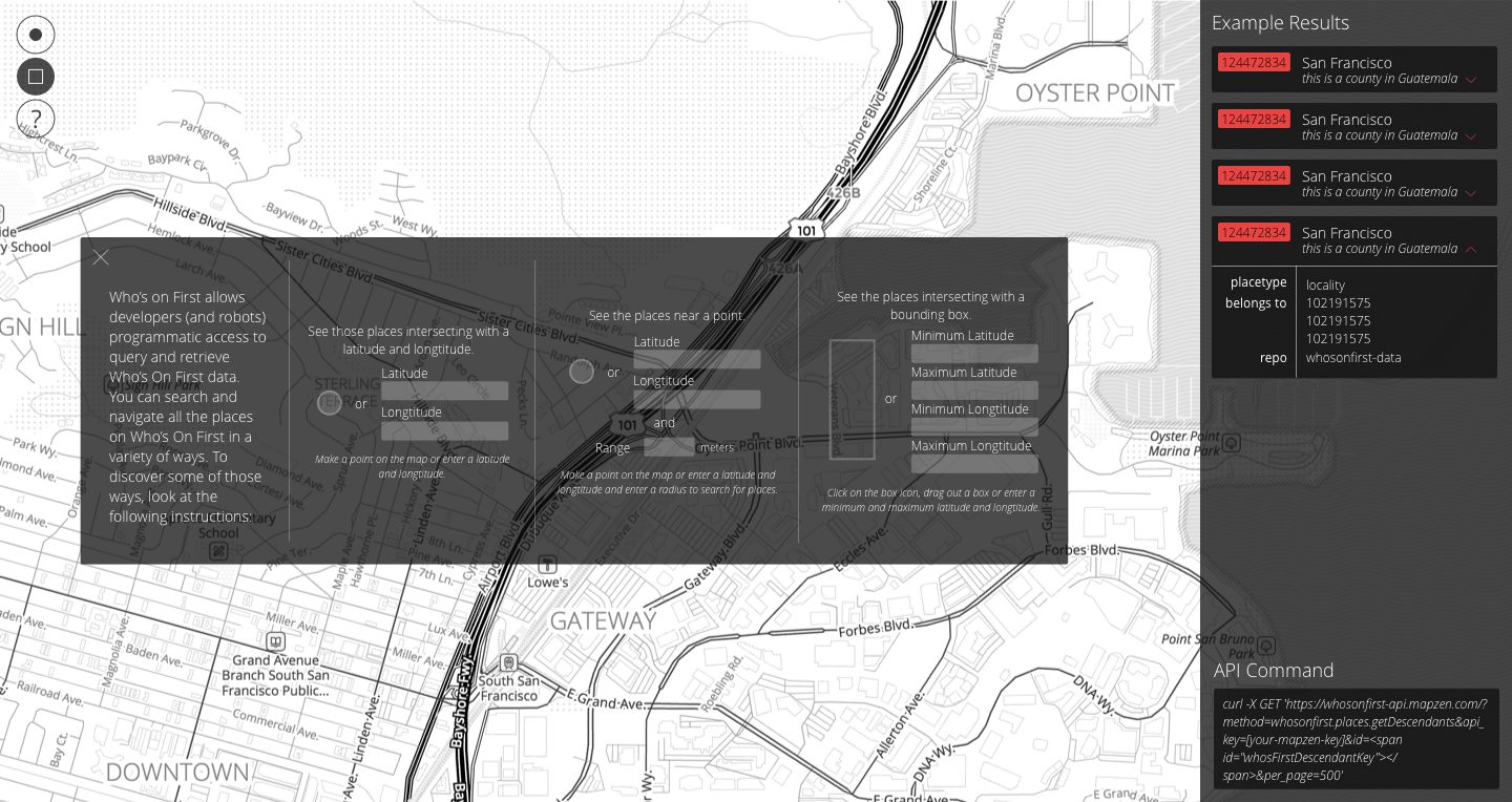
How can we most effectively allow for understanding, visualizing, and interacting with Who's On First?