Posts tagged: mobility

A "data-driven" approach to improving map-matching, Part I
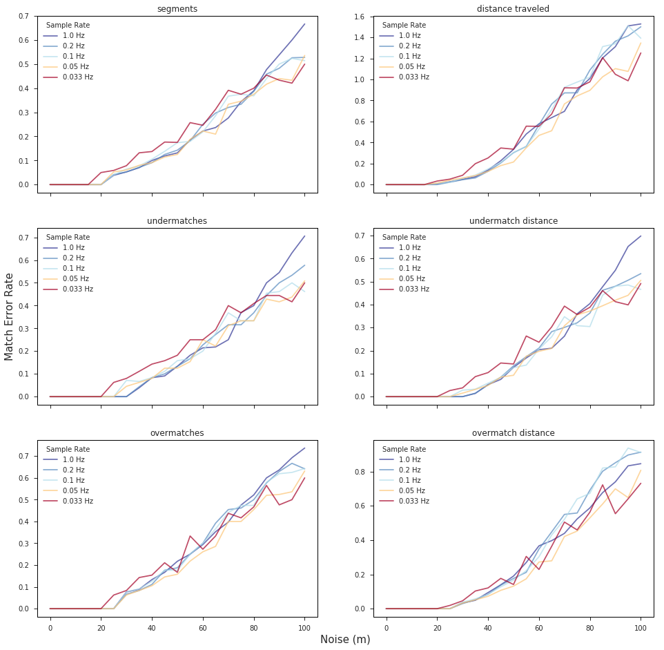
We wanted to take some time to explain exactly how map matching works, and how we use it. This will be the first in a series of three blog posts on how Mapzen validates, fine tunes, and deploys our map-matching services to meet the needs of our users.

Map Matching is ready to Flex
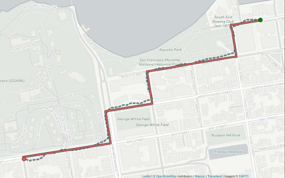
We're excited to release Mapzen Map Matching, the latest addition to the Mapzen Mobility services. Our Map Matching service takes in a trajectory of latitude/longitude coordinates and returns back a route line that is snapped to the OpenStreetMap road network and enriched with attributes, like speed limits and freeway exit signs.
Mapzen Flex expands your travel horizons!

Timed-distance matrix, Isochrone, Optimized route and Elevation services are coming to Mapzen Flex.
OSMLR traffic segments for the entire planet
OSMLR provides a stable linear-referencing system atop the ever-changing network of roadways in OpenStreetMap. We're now releasing a preview build of OSMLR segment tiles for the entire planet.
Statistics and validation reports for GTFS feeds in Transitland
Mapzen has been participating in a collaborative effort to help improve transit data practices, with the aim of bringing greater consistency and quality to GTFS open data.
Putting isochrones to work
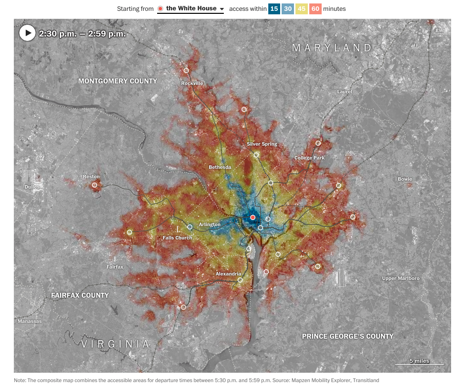
The Washington Post used isochrones to reveal the impact of transit reductions on lower-income communities
Transitland: One Year of Submissions
One year ago we opened Transitland to submissions. Now the Transitland Registry includes 1,511 transit operators in 37 countries.