Posts tagged: transitland


Analyzing historical transit service & GTFS publishing practices in Transitland
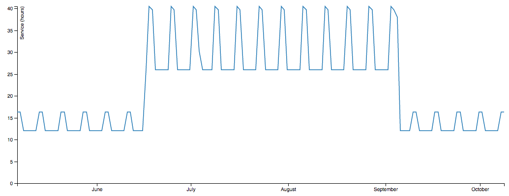
This summer we added 3,000 historical GTFS feed versions to Transitland, stretching back to 2008. Interesting patterns are emerging!
TransitFlow — using Python and Processing to visualize regional transit frequency
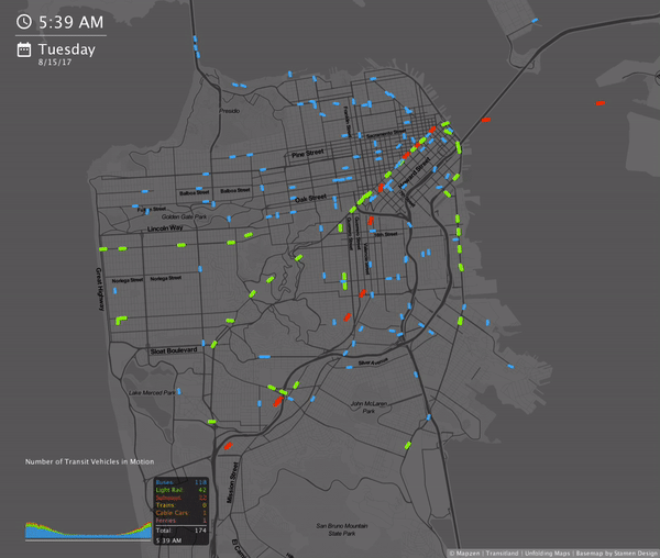
Transitflow is an experimental set of tools that generate spatial-temporal transit frequency datasets and visualizations from the command line.
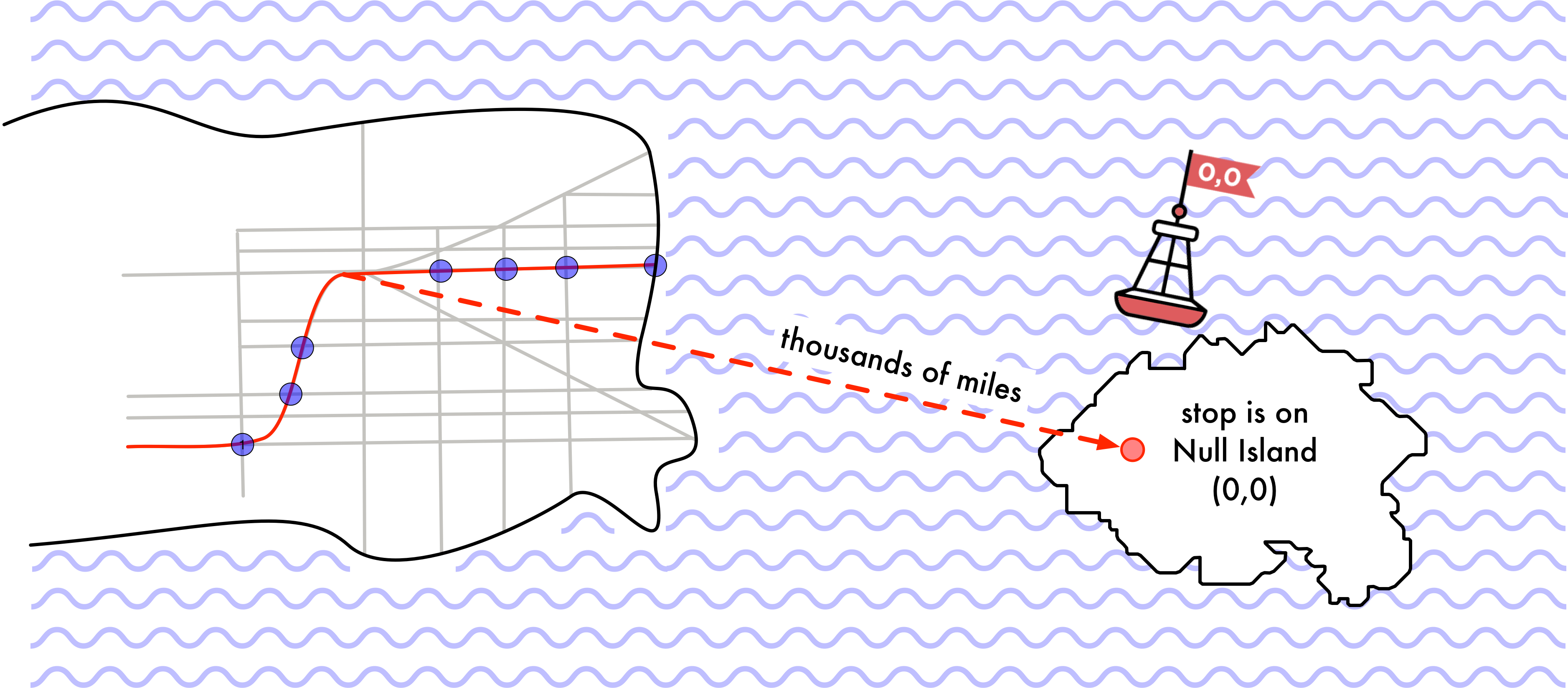
Statistics and validation reports for GTFS feeds in Transitland
Mapzen has been participating in a collaborative effort to help improve transit data practices, with the aim of bringing greater consistency and quality to GTFS open data.
Transitland: One Year of Submissions
One year ago we opened Transitland to submissions. Now the Transitland Registry includes 1,511 transit operators in 37 countries.
All roads lead to Washington, D.C.

Early every January, transportation professionals and enthusiasts gather in Washington, D.C. to talk shop. We'll be there to share Transitland, Mapzen Turn-by-Turn, and our collaboration with the World Bank on open traffic data.
Introducing Mapzen Mobility Explorer

Mobility Explorer provides an approachable way to query for and immediately visualize Transitland data and Mapzen Mobility APIs. It's built for developers of maps and apps, public policy advocates and planning experts, transit nerds, and anyone who is curious about exploring transit data.